Locating Gustaf Lindstrom's Homestead
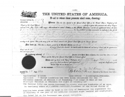
The following homestead certificate, signed by President Grover Cleaveland on Feb 18, 1888, shows that Gustaf was granted the "Northwest Quarter of Section 6 of Township 7 of range 18 West of the Principal Meridian in Nebraska, the right tendency of 151 acres by 90.1 acres."
This certificate uses the [Public Land Survey System] (PLSS) to describe the location of the homestead. PLSS starts from a reference point--in this case, Nebraska's Principal Meridian ([40.001944N,97.368889W]). Centered at this point, PLSS establishes a grid of land parcels that measure 6 miles by 6 miles. Each of these parcels is divided into 36 "sections" (which are numbered). Each section is further divided into quarter-sections (e.g., "the northwest quarter section")'.
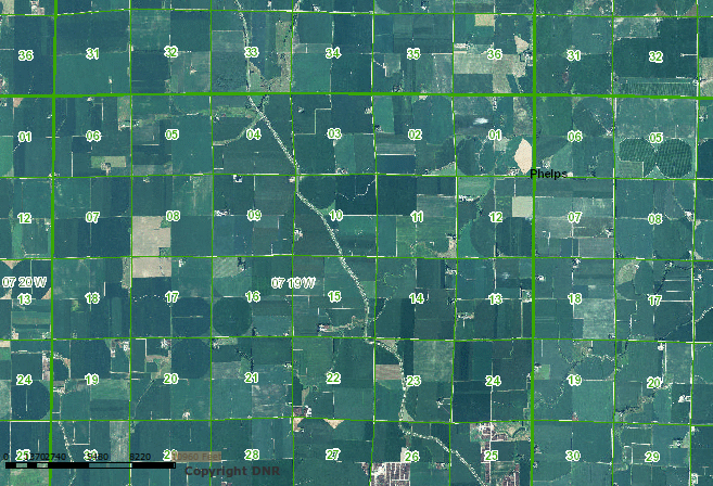
Gustaf's homestead was in Township 7 (36-42 miles north), Range 18 (102-108 miles west). Within this region, Section 6 is the northwestern-most 1x1 mile section, and Gustaf was in the northwest quarter-section.
The following aerial photo from the Nebraska DNR shows (7Nm 18W, S6):
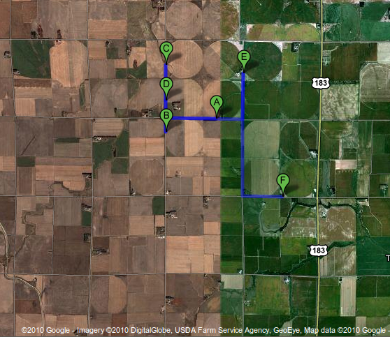
This [Google Map] (image below) shows the homestead, plus several other close-by Lindstrom locations:
A: Dean Randall Lindstrom’s first farm (where Randall Eugene Lindstrom first lived in Nebraska)
B: Dean Randall Lindstrom’s second farm (where Randall Eugene Lindstrom next lived)
C: Gustaf Lindstrom's homestead
D: Carl Gustav Lindstrom's homestead (where Aline Kleone Vaughn and George Delphin Lindstrom lived later)
E: Larry George Lindstrom’s farm
F: Nathan Charles Lindstrom’s farm


