Locating Gustaf Lindstrom's Homestead
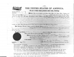
The following homestead certificate, signed by President Grover Cleaveland on Feb 18, 1888, shows that Gustaf was granted the "Northwest Quarter of Section 6 of Township 7 of range 18 West of the Principal Meridian in Nebraska, the right tendency of 151 acres by 90.1 acres."
This certificate uses the Public Land Survey System (PLSS) to describe the location of the homestead. PLSS starts from a reference point--in this case, Nebraska's Principal Meridian (40.001944N, 97.368889W). Centered at this point, PLSS establishes a grid of land parcels that measure 6 miles by 6 miles. Each of these parcels is divided into 36 "sections" (which are numbered). Each section is further divided into quarter-sections (e.g., "the northwest quarter section")'.
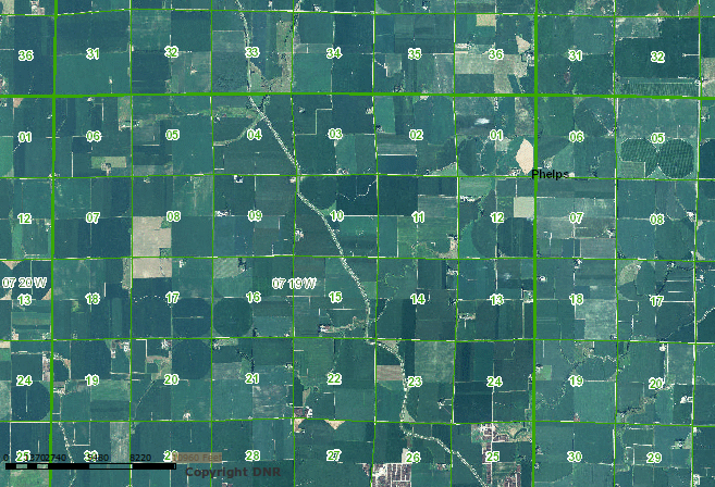
Gustaf's homestead was in Township 7 (36-42 miles north), Range 18 (102-108 miles west). Within this region, Section 6 is the northwestern-most 1x1 mile section, and Gustaf was in the northwest quarter-section.
The following aerial photo from the Nebraska DNR shows (7Nm 18W, S6):
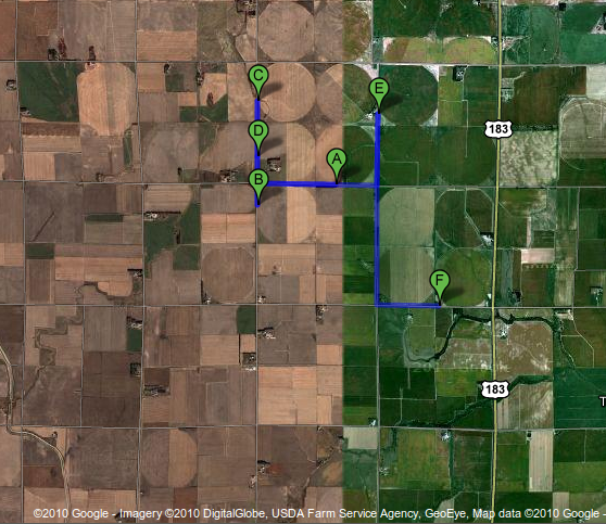
This Google Map (image below) shows the homestead, plus several other close-by Lindstrom locations:
A: Dean Randall Lindstrom’s first farm (where Randall Eugene Lindstrom first lived in Nebraska)
B: Dean Randall Lindstrom’s second farm (where Randall Eugene Lindstrom next lived)
C: Gustaf Lindstrom's homestead
D: Carl Gustav Lindstrom's homestead (where Aline Kleone Vaughn and George Delphin Lindstrom lived later)
E: Larry George Lindstrom’s farm
F: Nathan Charles Lindstrom’s farm
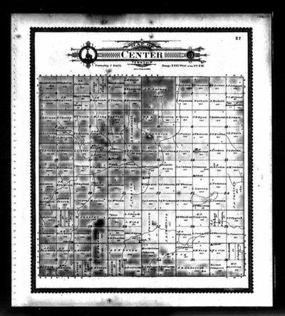
This 1903 map of Center Township shows the Lindstrom plots as well:


